Leafy Maps 🌿 (new free plugin)

@cliffwoodjames
In a custom map, like the GTA map? It could even be a dog picture as a map :yum:
If your project would benefit from different kind of maps and has the budget to sponsor it, send me a private message about it to talk about the possibilities :blush:

@martin.bedard Yes, it should be a small improvement, not a full blown new feature, send me a private message if you would be interested in sponsoring it :blush:

@vini_brito I have a question for you. I want to put an overlay image on top of my polygons. Is it possible right now? If it’s not, are you planning to add it?

Thank you

Hi @hakandemirpolat, you mean display an image inside the polygons? Or just on top of them? If it is on top of them, you may try doing something else using custom popups, if it is inside polygons, then a new feature would be necessary.
If your project has the budget to do so, you can sponsor the work to create such new feature, just send me a private message :blush:

Hey @vini_brito ,
Just wondering if you had considered adding MapTiler Cloud as an option?
I found them through OpenMapTiles…from the OSM site. I know people in the bubble community are always looking for more competitive and scalable map options for their apps. They might be terrible but I don’t know…thoughts?

Cheers

1 Like

Chatting on a PM :blush:

@sergey.titkov I am experiencing the same issue in Leafy, with map markers (and also polygons) being displaced when zoomed. Did @vini_brito help you with a solution?

Not yet, do file a bug report here as I am still collecting info Unlimited Bubbling - Report a bug :blush:

1 Like

@vini_brito Great plugin! I am having an issue with “This LeafyMap’s Clicked map coordinates Latitude.” I can do the same thing for longitude with no problems, but the latitude is not getting picked up. Any idea what’s causing this?

I’m pleased to report that as of 6.3.0 Leafy now supports point in polygon analysis using multiple polygons. Thank you @vini_brito !

1 Like

Are you picking it from a workflow under the event “map clicked”? If so, it should be available just fine. In this case, file a bug report please (:
Unlimited Bubbling - Report a bug

Hi @vini_brito,
I’ve been looking for a maps plugin to replace Google and came across this plugin…
After reading the threads, this plugin sounds great (great work!) but when I’m trying to check it out (example links that are posted here), the map element is not showing (missing element),
is there something wrong on my side?

Not on your side :blush: some examples are intermittently broken due to a logistic issue, eventually I will muster the resources to invest in consolidating the documentation in a proper place and form.

New provider added! :grinning_face_with_smiling_eyes: :partying_face: :sparkler: :tada:

Meet MapTiler, a map provider that offers a cost more affordable than even Mapbox (and Mapbox is already cheaper than Google Maps).

The benefit of this provider in this plugin not only is the very competitive and scalable cost, but the option to create custom maps. Yes, you can customize a map in their online editor and then display that in your app :blush:

Custom maps:

Here is a quick instruction on how to use this new provider:

Of course first install the plugin, Leafy Maps.
On the plugins tab inside your app, paste the provider key that you can grab from them after creating your account:

image

Then select MapTiler from the list of providers:

image

Then write the name of the map tile you desire to show:

image

If you want to display a custom map, grab the key from your custom map dashboard item:

And paste it here like this:

image

Also, as of today, if you are on the generous free plan you are required to show the MapTiler logo, so control it yourself through that yes/no field.

And here it is!

This one is the hybrid map, that shows the satellite with contextual information.


And a friendly reminder :wink:

Leafy Maps is an open and community led plugin!

If you would be interested in adding more features that this, or any other provider offers, and even features unrelated to a specific provider, then you can sponsor the work needed to build that new feature! Just talk to me :blush:

So this plugin is made by you and for you!


@gilleslaurent67 In case you are still around :blush:

2 Likes

You need to use the workflow action: “Show map on leafy map” to tell leafy which map provider, center and zoom

2 Likes

Hi Vini, you are amazing my friend, I’m part of some groups with you and I learn more and more, I’m from Brazil :slight_smile:

As for the plugin, I would like to ask two things, namely:

1 - is there a possibility for the user to click on location and bring the information of latitude and logintude of the clicked location?

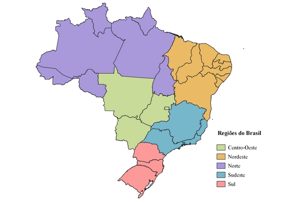
2 - is it possible to highlight only the states or regions, and then click on them? for example, Estado do RJ is highlighted on the map and I can click on the highlight.
exe:

Does it possible to make responsive of high? I need to do full high of screen, for mobile and desktop with different resolution

1 Like

+1 on height responsiveness

And I’m experienced an issue where I can’t drag the map around. it’s resisting to be dragged.

I’m using maptiler. responsive and non-responsive pages. only show map workflow. no other setting except map name and latitude and longitude.

Is anyone else having an issue when viewing your map on an iPhone where it does not register when you click the map. I have my map setup to add a marker wherever you click and this works on my pc and my android tablet but not on my iPhone. Is there any reason for this?

I did high responsiveness with “Dynamic Height and Width” by zerocode,

1 Like

So in order to have the map register a click on and Iphone or Ipad you have to setup the map to recognize the left click of the mouse instead of the right click. The issue is when I change my map from right click to left click the latitude is no longer passed on and is left blank, which causes an error. Is anyone else having this issue or is there a work around?

1 Like