
Use bdkmaps
It doesn’t currently offers that specific feature, but it’s possible to be implemented, if you’re willing to sponsor it then there’s a way we can make it happen.
Feel free to private message me if makes sense for you to proceed in that way 
Hi @vini_brito, your plugin is amazing!
Is it possible to use it to draw a circle with a radius on a map?
I see that that this possibility is mentioned in Leaflet’s documentation (https://leafletjs.com/reference-1.6.0.html#circle-option), but I have a hard time figuring out how to add this option to the plugin.
I have tried to use the Check if point is contained in rectangle and the Draw polygon workflow, but it doesn’t work…
Is this something that can be done with your plugin ?
Thanks in advance for your help 
Hello! That’s not currently available in the plugin, but as you imagine it can be implemented in the future.
1 Like
oh okay, thanks for your answer.
Folks, I have a layman question. My app uses geolocation to locate users and calculate distance between them. Currently Bubble relies to Google geocoding API for this functionality and is asking for the API key. How do I implement a free alternative API Key for geocoding? Google as you know is asking for payment details and its not free.
Thanks
1 Like
Hi @vini_brito!
Thank you for the plugin. I am playing with it to figure out whether it fits my app.
I have a list of points/nodes with coordinates. I need to show this list of points as markers on the map. I failed to do this with the plugin - I can either add one marker or draw a line with several markers (and I don’t need a line). Did I miss something?
Also, I’ve noticed that the pluging doesn’t accept dynamic data for the initial coordinates. I want to show the map with the initial coordinates of the user’s current location. For dynamic data I tried to use the location detected by the leafy plugin, and another GPS tracker plugin. In both cases the map was not shown. It only shows the map when I indicate static data - just indicate latitude/longitude.
Maybe it’s a bug? Or am I missing something?
About the first point, it seems to me you want to add several markers, right now you can do it manually by using multiple times the “Add marker” action or you can do it programmatically using list shifter plugin to loop through that list and in each loop you add a marker. I’ve decided to add a feature “Add a list of markers” in the future, but no ETA on that.
About the second point, I don’t quite understand. These fields do accept dynamic data source.
If you can send me via private message a link to your app with view enabled or screenshots of related workflow actions and data types so I know what’s being passed, then I can further help you
2 Likes
As with the list of markers, your solution is feasible for small numbers of markers. In my use case I have a list comprised of dozens of markers. They need to be shown all at once and without using geocoding (I use only coordinates). This is actually done through the Google Maps Extended plugin.
I’ve sent you a link to the editor of the app to check why dynamic data with initial coordinates doesn’t work.
Hello everyone using this plugin! A heads up, Mapbox has deprecated their tiles (maps) being used in this plugin, so you have to upgrade to version 4 of the plugin else your mapbox maps are going to be blank in about 16 days.
All you have to do is to upgrade the plugin in the plugin tab, refresh the Bubble editor, and then update all your “Show map” workflow actions by selecting inside them one of the modern versions of the Mapbox tiles.
If you use Stadia tiles, nothing changed.
That’s it for now!
Hi,@vini_brito
Thank you for your email response the other day.
I found this thread on FORUM and would like to ask a follow-up question here.
you can do it programmatically using list shifter plugin to loop through that list and in each loop you add a marker.
I’m currently using the “List Shifter” plugin based on this post, but I can’t make it loop about adding map markers.
The move I want to make is…
Get the address of the current location and save it in the DB.
Iterate the process and put a marker in LeafyMaps at the location of all the addresses stored in the DB.
but iterations don’t work and only the first data in the DB returns the marker. Why is that?
Do you want to know more about the material? Or is there someone who knows?
This is a translation software, so I’m sorry if the grammar is wrong.


This is a very cool plugin. I’m trying to figure out if it has the ability for a user to draw a rectangle or polygon or circle on the screen to indicate/select an area of interest. Does this plugin do this? Or is there any tool available in Bubble that does this?
@KotaroIzumida That would require some time debugging the app’s logic… try using the debugger and see what’s going on.
@antony.hodgson I’ll have news on this very soon, hold on for a couple days and see if it will serve you (:
1 Like
@vini_brito - thanks - excited to see what you’re working on! Please post here when you’ve got something for us to see.
2 Likes
I finally took the deep dive into your plugin after realizing google maps would be draining the bank to scale up with. This plugin is proving to be a terrific replacement for google maps.
On the first hour of playing around with the plugin I have some questions about customization.
Specifically, when using the mapbox satelitte-streets-v11 is there a way to remove the ‘places’ and show only the street names?

I’d like to decongest the map and get rid of all the icons and names of unrelated businesses and show only the map marker and the street names.
Is that possible to do?
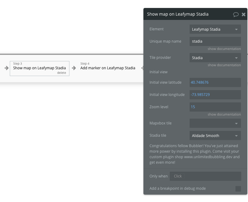
Also, I am trying to get the stadia maps to function but on page load I am getting the following errors in the debugger

I put my domain name into stadia and also added a key token to the plugin in bubble for the get route path. I have a feeling I am missing something in the setup. Currently on the free plan from stadia.
This is the workflow set up

](https://bubble.io/page?name=index&id=pomodorotechnique&tab=tabs-6&subtab=General!%5B28%7C690x347%5D(upload://oQxjjzE1QjNGRdpFUZfBZXeaPUm.png))
2 Likes
So I figured out why the Stadia map was throwing the error message. Turns out, you can’t have a Stadia map load at the same time or after another map is loaded, at least another map coming from mapbox.
Interesting though, a mapbox map will load after a stadia map has. Another interesting point is that Stadia map maintains its functions for zoom and pan after a mapbox maps has been loaded on the same page.
Still have that burning desire to get rid of the other businesses from the map.
Also, thinking about how it would be nice to design our own tiles. Got an email from mapbox about designing one.
Anybody know how we can import our own tile designs for either mapbox or Stadia or perhaps both?
1 Like
Is there a limit to how long the “line” can be i.e. how many points the line supports?
@vini_brito is it possible to add a workflow event to ‘show popup’?
I have a list of retailers in a RG that I can click and pan to the marker as well as zoom in on the marker, but I’d love to get the ability to show the popup as well.
Also curious if it is possible to customize the popup using HTML?
This is weird, I’ll see if I can reproduce and fix this, the elements should not behave this way.
Exactly one of the main reasons this plugin has been created ![]()
No, as it only draws ready made maps and these units are part of the map image, so to speak, which leads to your follow up question
I’m aware of their very interesting studio, after some tinkering I sent them a request on how could it work, so whenever they respond I’ll update you about this (:
Yes to both, if you’re willing to sponsor such features send me a private message ![]()
No, I’ve seen lines with hundreds of points appearing fine.
Hello everyone! A new update with a new feature, upgrade at will.
-
Now the user can create polygons by clicking Control-Left + Mouse-Left on the map, so one click will generate a point, 2 will generate a line.
When the user clicks Control-Left + Enter the first point will join the last point and the polygon will be created. The user can also delete the last point by clicking Control-Left + Mouse-Right, or clicking Control-Left + Delete to delete all created points. -
We’ve created the field “Enable Drawing” in the “Show map on” workflow action, so you can enable or disable the drawing mode described above.
-
We’ve created a workflow action “Set Drawing Style”, so you can change the style of the polygons that will be draw in the drawing mode.
-
We’ve created a workflow action “Load Polygons List” that receive a text with instructions to create a list of polygons in the map. You can also change the style of the polygon in the workflow action properties.
-
We’ve created a state “Polygons List” that is a text with instructions to recreate all polygons that are inside the current map. Note: You can save it on the data base to use in the “Load Polygons List” any other time.
Example:
Edit mode: https://bubble.io/page?type=page&name=leafy_draw_polygons&id=pdf-conjurer-testbed&tab=tabs-1
Run mode: https://pdf-conjurer-testbed.bubbleapps.io/version-test/leafy_draw_polygons?debug_mode=true
Happy bubbling!
4 Likes