Thank you @ZeroqodeSupport for your great customer support – looking forward to the demo update.
The part I can’t figure out is: how to trigger the “Point is in Polygon” evaluation. I put the Marker in the First Polygon, but still the “Point is in Polygon” always returns “No”
Hi @greg18, apologies for the delayed reply (due to the weekend).
Thank you for the provided video. Allow us to check it internally with the developer team.
Once any update will become available, we will let you know.
In addition to the provided video, would it be convenient for you to add our support@zeroqode.com as a collaborator of your app?
That will allow us to check what’s wrong with your setup and test it out in our workspace.
Enter your Bubble editor page → Settings → “Collaboration” tab → Invite a user (email). (Note: disregard the warning message regarding the plan, as we are an agency and you can easily add us to your collaborators.)
We will check your setup and do a few tests in an attempt to find the root cause and help you fix it.
In case it is ok for you, please us know.
Kindly note that all three of them can be realized through the customization of the Mapbox style on the mapbox platform.
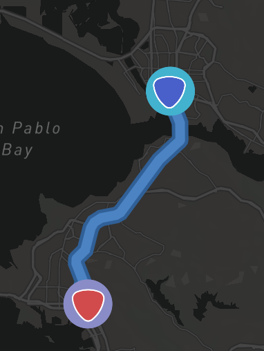
Sorry I do not understand where these settings are within the Mapbox platform that would change the “Mapbox Maps” plugin “Set Directions” route color and the other two requests. Please post a screenshot showing where to update these settings in the Mapbox platform.
As further info, as you can see in my previous screenshot, I’m not using a custom style – it is simply the standard Dark style. Regardless of whether it is a custom or standard Mapbox style, I would expect these requested settings to be located within the Mapbox Maps plugin (similar to how the Leafy Maps plugin enables different colors of the directions route) – I do not think these settings are within the Mapbox platform.
Note that I found this Stack Overflow post which describes how to remove the A and B route markers by configuring the Mapbox Directions API – but I don’t know how to do that. I think the Mapbox Maps plugin would need to be updated to include these settings.
OK I have added you as a collaborator. Please take a look at the Point in Polygon demo on page zz-poly-2 and let me know what I’m doing wrong.
Hi @greg18, thanks for your reply and provided access.
Apologies for the bit of erroneous information in our previous message. Currently, the Mapbox doesn’t allow to set up route color/remove reference point circles through their standard functionality (by now it is possible to change colors only of the static objects). Changing the route color and remove circles requires additional customization through JSON coding.
We will check how feasible it will be to add the requested feature to the future plugin update, thank you for suggesting it.
Allow us to check with the developer team and come with feedback asap.
Thank you for understanding.
Just wondering on a use case for this plugin - can it be used to live track multiple users? For instance a courier company live tracking all their couriers - one map with multiple moving (customised) markers?
Unfortunately, the current plugin functionality doesn’t allow to build of such a use case. Sorry for the inconvenience .
Let us know if we can help with anything else related to our plugin.
Theoretically, this might be realized through the GPS Live Tracking plugin. Kindly note that such setup would require an advanced Bubble skill and due to the Bubble platform and used plugin particularities, will have its own limitations.
See a relevant thread here:
Thanks @ZeroqodeSupport for updating the Point in Polygon feature. It now works for when a polygon is drawn by the user using the “Draw polygon” action.
However, it does not work when a polygon is loaded by the “Create line” action (with the “Type” set to Polygon).
Can you please update the plugin to also accept a polygon created by “Create line” [Type=Polygon] for the Point in Polygon analysis?
Hey guys, I tryed to implement places from google with mapbox but I have this error “Action Add List of Markers MapBoxMap A - The plugin “Mapbox” Maps / action Add List of Markers a MapBox Map threw the following error: UnexpectedError Invalid fieldName: undefined”. I tryed a lot of things to solve my problem, but I can’t solved
That’s my configuration
We suppose that the issue is reproduced for the reason of incorrect settings for this action.
Please find our screenshot with the current ones and pay your attention to “Marker Source” and “Marker Type”:
Please note that these fields should be used with specific settings: Markers Type - Indicate a type of markers from your database; Markers Source - Source of markers. Use Do a search for...
Please change these fields and let us know if they are working properly.
Looking to hearing from you soon.
Best regards,
Zeroqode Support Team
Hi @ZeroqodeSupport, sorry if this has already been answered but I couldn’t find it.
I’m trying to save the GeoJSON of a drawn polygon to call it later. As in, the user draws a polygon, then I save the GeoJSON to the database and this is used to check point in polygon or display polygon in other places of the app.
When I use this workflow nothing saves in my database - is there some other way to capture the GeoJSON of the drawn polygon? In your editor you don’t save anything after the polygon is drawn and the coordinates to display a polygon are hard keyed so I’m unsure how to save this value. The data type field type is text.
Thanks @ZeroqodeSupport - if I run it step by step in the debugger the GeoJSON value saves, if I run normally it doesn’t. I did work out that it’s not the GeoJSON i need to call to redraw the polygon rather the line coordinates based on the ‘draw line’ action, but there’s no access to just the line coordinates of a drawn polygon, only the GeoJSON (it would be good to support geoJSON for drawing polygons though)
Please allow us to notify you that we have fixed the issue with saving the GeoJSON within the plugin and now, it works properly.
Kindly ask you to upgrade the plugin to the latest version and follow these steps:
The plugin saves the coordinates of the drowned polygon in the DataBase (by using the button from the screen) and after it, you can use the saved data.
Hope it will help you. In case of any plugin-related questions will appear- let us know.


 Please let us know if we can help with anything else related to our products.


