One of the things sorely missing is the ability to add a list of markers from a list of geographical addresses NOT as list of lat and a list of long…same with set route from a list of geographical addresses not lats and longs.
Or maybe I’ve missed something and that’s been added in as well?
What I couldn’t accomplish, but would need urgently:
The pickup and dropoff locations should be shown on the map of packages with a blank assigned driver field. (pickup with green, dropoff with blue marker color) If a user clicks on a marker, the location’s ‘details’ page should open (showcasing opening hours, streetview photo and packages with blank assigned driver field AND address matching in pickup OR dropoff field)
Is it possible with this plugin? Can you suggest a workaround for this?
If this assistance needs payment, please PM an estimate.
I have two questions if you don’t mind me asking.
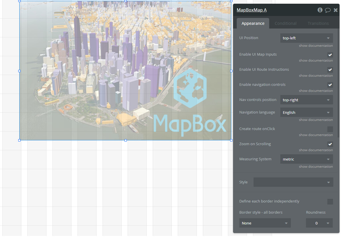
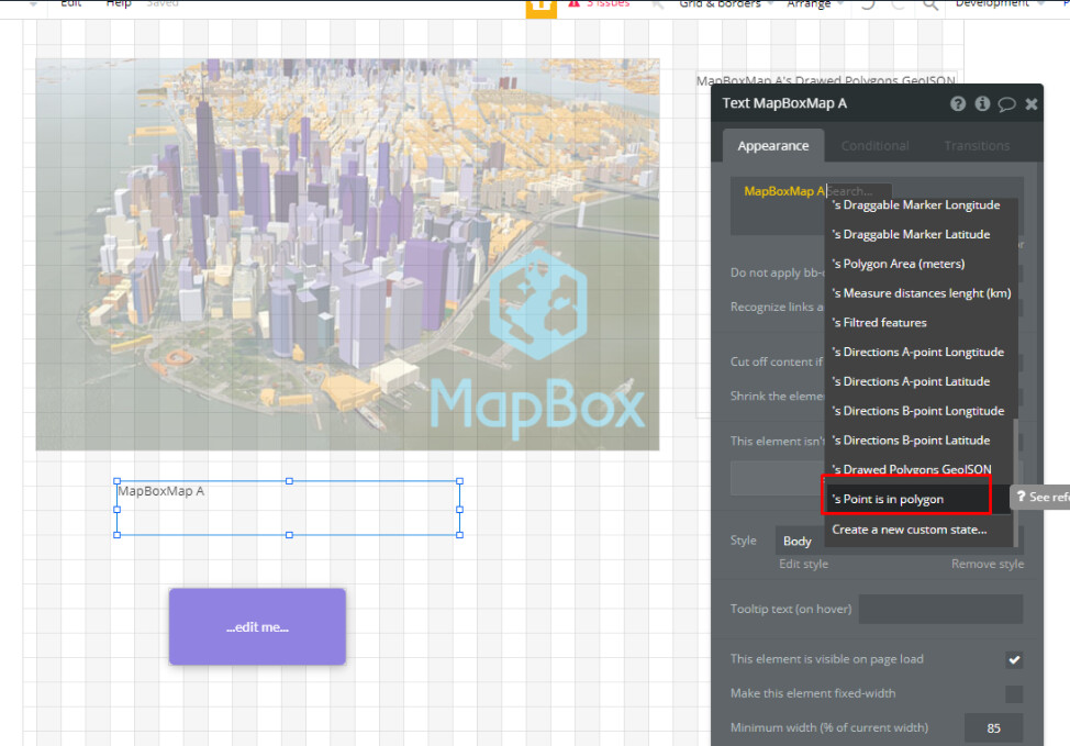
Firstly, when drawing a polygon, are we able to get the geoJson from the newly created polygon? I had a look but I couldn’t find anything in docs/editor to get the geoJson/array of lats and lons.
Secondly, is there a way to check if a point is within a polygon? (using geoJson or similar)
Hello, @equibodyapp
Thanks for your patience and time
By this message, we would like to notify you that we have taken into consideration your request and added a possibility to set the position of markers using the geographic address.
Please upgrade your plugin to the latest version ( 1. 33. 0.) and give it a try. It will help you to work with an upgraded version of the plugin.
Thank you for upgrading the plugin. However I’m having trouble with the Default Map Position.
I have been using version 1.29.0 of your plugin, which has successfully loaded my custom Mapbox style, with the Center of the map at the Default Map Position as specified in Mapbox Studio.
Once I try upgrading the plugin to 1.30.0 or anything newer, the map loads with the Center at (0,0) off the coast of Africa rather than where my map features are.
Am I doing something wrong? With the upgraded plugin, how do I set the map to center on the Default Map Position as specified in Mapbox?
I am having a second issue – I can’t get Mapbox elements to vertically resize in order to be vertically responsive. I’m using the Zeroqode plugin Move or Resize Elements but it is not working for Mapbox elements. It works for other elements, so I think the problem is with the Mapbox plugin.
Please let us know if it works as required or any other support is required.
Unfortunately, the current plugin functionality doesn’t support such an option. Sorry for the inconvenience.
We can only provide a general direction, for example, to show the attribution through an HTML element, see more information here: Attribution | Help | Mapbox
Please let us know if we can help with anything else about our plugin
Thanks for your response but still not working – let me explain further:
I am currently using Mapbox plugin version 1.29. On that version, when I use the Set Style plugin action but do NOT use the Set Center, Set Zoom, Set Pitch or Set Bearing plugin actions, then the map will be displayed with the center, zoom, pitch and bearing at the saved “Default map position” settings that I set in Mapbox Studio – this is my desired behavior.
However, when I upgrade the plugin to 1.34, again I don’t Set the Center, Zoom, Pitch or Bearing workflow actions – but now the map is centered at (0,0).
I don’t want to duplicate these settings from Mapbox Studio to the plugin. It’s easier to configure these map settings within Mapbox Studio rather than the Bubble editor.
Can plugin version 1.34 please function like 1.29, so that if those workflow action settings are not specified, then they will be pulled from the “Map default settings” embedded in the map style?
they answered me in another forum about the plugin. Sadly they currently don’t have features for outputting the geojson, nor action/feature to check if a pin is in poly.
Leaftly has this function, however was little basic for my liking
So im just working on something myself for this
Today we have pushed a plugin update, that has added the required features (limit the number of polygons, check if location pin is within polygon).
To check changes, please upgrade your plugin to the latest version (Version 1.35.0: added new functions related to the polygon drawing tool) and give it a try.