I am currently developing a Sales Rep Territory Map & Database, I’m wondering if anyone has experience with something similar that might be able to point me in the right direction, in case I should be using different tools, plug ins or elements for this task. I definitely don’t expect anyone to do this for me, but knowing what the right direction to move in would be so helpful!
I am using a geojson file to draw polygons of the suburbs of South Australia, a snip of the code below.
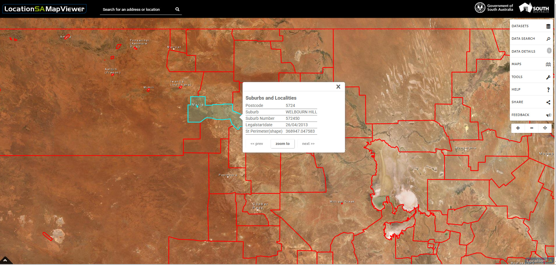
Currently, I am using a HTML Element (code pasted below) and the leaflet interactive map with polygons is working great. But when you click on any polygon, the text bubble only appears on a specific polygon as shown in the screenshot below, it also pans to this suburb instantly and zooms in heaps, if this specific polygon is not in view. Hovering across the polygons highlights them which is cool.
Ultimately, I am trying to set this up so postcodes change colour to the colour of their assigned rep, to map out sales territories. When clicking on a surburb’s polygon, I want the speech bubble to show Suburb Name, Postcode, Assigned Rep and a button that can be clicked to edit the assigned rep.
I am trying to create my own version of the LocationSAMapViewer on the same website I sourced the geojson data from.
I really appreciate the help!
#bubble-map, #bubble-map * { pointer-events: auto !important; }