I think it would be great to get more functionality out of the maps.
Make the markers conditionally responsive. For example, my current map is set up for business listings that open and close. It would be great to have conditional capabilities to say “when this maps markers business listing is closed” then “show this marker”…the show this marker would just simply be a image upload just like there already is
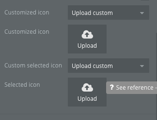
except this would be in the conditional area…it would be like how we have control over the conditionals of icons.
More control over the styling of the marker caption. To be able to “skip a line” so that we could have a multiline marker caption that would read like:
Business Name
Street Address
Star Rating
This way we would be able to make use of the marker caption to provide more information in a visually appealing way.
Alternative to this would be to give the ability to set a groupfocus to have a reference element of a map marker, which I think would be trickier than adding formatting options to the existing marker caption.
Enable a feature to allow a repeating group to get updated based off of the maps location.
I think giving maps a datasource of “search for all business whose geo location is within the boundaries of this map” and then to give a repeating group the ability to use a map as it’s datasource.
ie: group datasource = Map_business_listings list of businesses; this list of businesses would be updated as the user zooms and scrolls or drags the map to different locations.
The datasource for the map would use the maps center location and zoom level to search for all listings in the maps boundaries.
I understand having these types of features would be difficult to implement and that the changes that have taken place with map features over the past two years has already helped a lot, I believe these features would really benefit most of the bubble community
Also would be nice to have conditional for changing the marker when the zoom level is x
This would allow us to have different size markers displayed at different zoom levels so that the map doesn’t get too cluttered with large icons when zoomed far out and the icons aren’t too small when the zoom is close in
On conditionals provide a property to change for the datasource as well.
If we could get a property to change for the marker and the datasource that would be great.
@gaurav
Thanks for the reply. Checked out the demo and looks like it does have some of the features I am looking for.
Some things you may be able to clarify for me about the abilities of the plugin, as I really want something that is “integrated” with the Repeating Group that stores the listings to display.
Is there a way to get it so that when a user zooms out on the map itself for the repeating group to get updated and display more listings, or vise versa and if map is zoomed in, the repeating group would how less results.
What I’d like is for the user to initially set their search results up in two different ways if they choose to. One is the typical enter in an input field. The second way would be via the map, so a user could select an area on the map and then through a button press set the search results.
What this essentially is a workflow event that sets the repeating groups list of results based on the boundaries of the map as set on screen.
How detailed can we be when selecting a different icon based on the datasource. Specifically would I be able to ( and from looking at the editor I believe it might be through a conditional and setting a filter on my repeating group search results ) have a different icon depending on if the location is currently open or close?
Is there a way to have an automatic close of the marker information window when user selects another marker, the previous marker selected will have its info window closed?
Actually that’s how its already being done
The ‘visible markers’ output of the google maps (bdk) element outputs the list that’s currently visible based on the screen within the map’s visible boundaries. This is done in real time and you don’t need any workflow action.
You can just zoom in / out the map on demo page and see the repeating group data change to see it in action.
Yep you can have different icon. Infact if you’re looking at open / close, this plugin will make it a breeze since it supports multiple marker sets. Set the datasource of one set to be that of your open locations and another to be of your closed locations and select different marker icon for each set. That’s it!
Good idea. The auto close of marker info window isn’t there yet but I’ll look to adding it in the next update.
Also, I recommend just subscribe to the monthly one, try it out in your app. Then if you like, simply unsubscribe and buy the one-time payment. If you don’t you would anyways have been charged only pro rata for number of days used of the plugin.