Quick question for you. I am also using Geojson.io to generate my geojson files. First I get the source data from openstreetmap.org, then generate the geojson code on polygons.openstreetmap.fr/ and finally I copy/paste that on geojson.io. The process is super annoying and takes ages.
Do you have any tips on making that more efficient ?
Hi @maxime12,
Yes that’s correct… not possible right now to change them dynamically (they are loaded when the map is first loaded). I initially thought that since you can provide multiple files to load all your geojsons at once it would solve most use cases. However what you mentioned makes sense and made me re-think my assumption. I’ll see if I can make that list dynamic Thanks for the feedback.
@Tomdez1989
Is the issue using geojson files? If you’re suggesting using providing geojson data using a dynamic input instead of file, can you share some example where that’s being done (maybe a documentation page on google maps) so that I can look deeper into it
Hihi @gaurav, no this is not the issue. My question was outside of bubble’s scope. I am looking for a simpler was to generate geojson files from openstreetmap that I can then use in bubble.
Hi,
Is it possible to set up this??
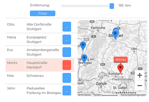
Would I be able to show the location of all the users on this map by City? Users would be able to connect with each other based on city.
Is possible, please lemme know how I can achieve this? It would be great help
Hi @gaurav, I’m playing with the plugin for 2 days already.
I like the simplicity of use even if it might restrict capabilities at times. I have a few questions for you:
1 - Are you planning to allow GeoJSON to be added/removed one by one at some point ?
2 - Directly related to point 1), have you thought about implementing a “point is in polygon” function ? That would make the use of GeoJSON much more interesting.
3 - Do you think you will allow us to modify the clusters design ?
4 - I think it would be nice to have the option in element action to “display list of markers” thus overwriting the map element’s initial source (the use case is when lots of filters are applied to be able to keep the “visible markers” feature without creating circular refs)
5 - Just a thought, the way you did might be intentional but wouldn’t it be nice that infowindows close automatically not only when you click on another marker but also when you press somewhere on the map or when mouse moves out of the map ?
6 - Finally, a cool feature would be to create an element action that allow to show infowindow when a condition is met.
Hope my feedback is useful, and obviously if you think I missed something in your plugin and my comments should not be then don’t hesitate to correct me.
Hi Guarav, I’ve been using your bdk map and it’s all working really great.
Im just wondering how I create the pop ups that appear when you click a marker. I can see that it’s linked to the html code but I can’t find that code in your editor. Where can I find it and how do I implement it?
Potentially yes. Will look into this in the future updates
Yep. I plan to add feature for you to provide your own cluster icon and font color of the number for each cluster
It would complicate other parts of the code quite a bit so don’t think I will be able to implement this anytime soon
The visible markers are autocalculated and output in real time by my code. If you use it as source data to generate visible markers that would cause the circular reference.
That was intentional. I looked into the general implementation across different sites and most standard implementation is to have either the multiple info windows either be open / close one when another is clicked.
Intersting idea Will think through the actual implementation so that its easy to build, use and applicable across multiple use cases
The popup for a marker will display the provided html inside. This allows for different bubble developers to design & display custom data in the popup the way they want it.
Where do you provide the HTML? In a text field in the object which you’re using as data source of markers. Simply select it in the ‘info window html’ of the google maps (bdk) element.
For any given marker the corresponding html content stored by you in the text field will be pulled up by the plugin and displayed there. I recommend checking out the editor (especially the data tab & design tab) and demo for the Google Maps (bdk) plugin; links shared here
Hey @gaurav, loving this plugin in so far! great and necessary extension to the maps plugin! I noticed that the bubble maps plugin has the ability to set a custom ‘selected’ icon for the marker. Is this possible with the bdk map or do you have plans to add a custom icon once a marker is selected?
(p.s. will be reaching out to you and the bdk team soon to wrap my bubble app and push the iOS and Android stores - so impressed to date!!)
Trying to include a KML layer but nothing shows up on map - I must be doing something wrong here.
The expression in the “KML Layer Files” evaluates to a list of files. I also verified that my KML file is outputting the correct track as it loads in Google maps and other platforms correctly.
Hello Gaurav,
I am also keen to know if you will be implementing the feature that @mirko.heimburger suggested awhile back where mouse-over google map marker trigger a condition on other elements (such as on RG) and vice versa, see below extract from his earlier post:
I need this feature for my real estate app and hope this is in your planned release.
thanks
I’ve been noticing a bug that we continue to have when we have the map on mobile devices. It seems that the map keeps auto panning back to the map center without being asked to once the map is interacted with.
I get the impression from looking at my Google cloud console that it is counting 2 map loads per page load i.e. the BDK map + Bubbles map. This would quickly become a cost problem even with a moderate amount of users on my app.
Do you have any thoughts on this? Is there a way to prevent the duplicate map requests to Google?
Hey @gaurav. Awesome plugin! I recently purchased it, and I think it’s going to be really helpful for the route management tool I’ve been building. I’ve spent the past few months working on this project almost full-time, and I feel like I’ve become an expert on the maps plugins available (and their short-comings). I have kept track of some of their features or lack thereof in this Google sheet. I think anyone who worked all of these features into a single plugin could blow the competition out of the water! I know I’d pay more than $16 for a maps plugin that did all I need it to do.
Hmm… could it be that there’s a dynamic data in map center which keeps refreshing, thereby asking the map to refresh? Current users’ location would be an example. Or maybe the element action ‘Pan to center’ is running repeatedly in your workflow?
Technically yes but given the constraints of building bubble plugins, I had to restrict this to taking the value from a field in a data object. So whatever info window html you have in the field will get rendered into the info window of the marker. To change the html, just change the html (or have the html itself have dynamically updating content?)
Great point. So the reason I ask for a bubble map element is so that it loads the google maps libraries using the api keys you provide. If I built the aspect of loading the library via the plugin itself, it would lead to conflict as bubble’s map / searchbox etc. elements would also try to load the library.
If you have a geographic address searchbox, bubble loads the library even then to my knowledge. In that case you may not need the bubble map element and just set the ‘Bubble library loaded’ field on the maps (bdk) element to be when the searchbox is visible. Under the hood, I simply ‘activate’ the plugin only after the bubble library loaded is yes.
Thanks for notifying this @Boost I’ll take a look. In the interim a workaround is to have a hidden repeating group, merge the lists on that and refer the repeating group list as data source on the map element instead
Appreciate the feedback. I’ll bookmark this for future updates A general issue I face is that while building features is easy, doing it in a ‘product-centric’ way (with the constraints of the plugin builder tool) so that most bubblers can use it without hacky workarounds takes time


 Thanks for the feedback.