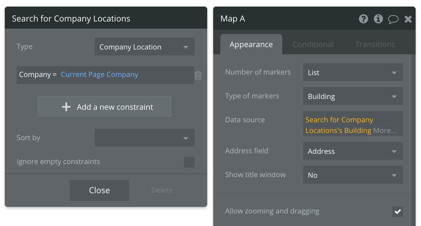
Hi everyone, just wondering how I might be able to plot addresses on a Google Map. I’m stuck trying to figure this out. We have Buildings and Companies in our application, where it is a many to many relationship. I have a table Company Location as basically a join table in between, where each record has the Building and the Company . From a Company detail page, a repeating group shows all Company Locations being the company’s locations/sites. So when viewing a record for 1 Company it lists all Buildings that they have a location in.
When trying to plot these on a map I’m having issues. If I put the “Type of markers” to Company Locations with the data source being Company Locations where Company = the current page’s Company, it won’t work because the “Address field” shows no fields that are an address.


It seems like the only way that works is if I pick “Type of markers” and put Buildings, then the address field lights up, but I don’t know how I would now filter it to only show Buildings that are on a Company Location that is related to the current page Company, or in some cases even further related.

Is there a way to do what I’m looking for?